|
The Kimberley - Broome to Darwin
|
|
|
|
About the Kimberley
• The Kimberley in Australia is one of the
last true wilderness areas on Earth, with rustic unique outback
landscapes and landmarks billions of years in the making. Covering
app 423,000 square kilometres in north Western Australia and with
a population of less than 40,000 people, it’s here you’ll encounter
some of the most extraordinary outback adventuresand folks in
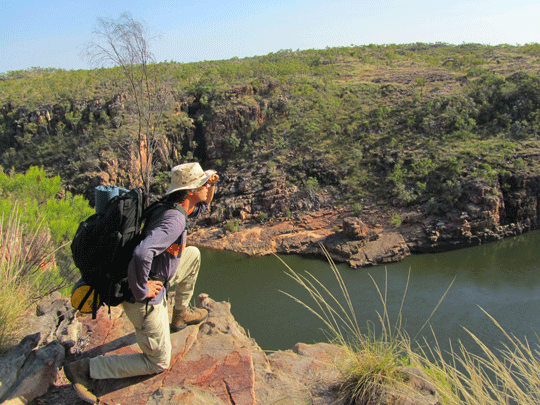
Australia. Discover ancient gorge country with hikes and trekking
a must in planning your Kimberley vacation to enormous cattle
stations, pristine coastline and sandy beaches, to one of the
oldest cultures on the planet and the world’s only horizontal
waterfalls.
|
|
Western Australia and National Parks (WA) towns,
rivers, roads, crossings, stopovers and places of interest (WA)
Map of the
Kimberley Western Australia |
Kununuura Region
Home Valley Station | Home
Valley Station | NT/WA
Quarantine Border Check Point | Wyndham
| Lake Argyle
| Kununurra
Gibb River Road Region
Durrack River - Gibb
River Road | King
Edward River | Gibb River River
| Ellenbrae Station | Gibb
River Road | Mt
Barnett Roadhouse | Mitchell
River National Park | Pentecost
River | Manning Gorge | Bell
Gorge | Dimond Gorge & Sir John Gorge
| Galvins Gorge| Lennard
Gorge | Mt Hart |
Mitchell Plateau Region
Kalumburu | Drysdale
River Station | Mitchell
River National Park | Mertens
Falls | Mitchell
Plateau | Mitchell
River |
Fairfields Leopold Downs Road Region
Fairfields
Leopold Downs Road | Geikie
Gorge | King
Leopold Ranges | Windjana
Gorge | Tunnel
Creek | Tunnel
Creek National Park |
Great northern Highway Kununurra to Derby to Broome
Fitzroy Crossing | Halls
Creek | Old Halls
Creek | China
Wall | Lilly Yard
| Sturt Creek |
Turkey Creek Roadhouse
| Mabel Downs
Station | Purnulula
National Park (Bungle
Bungle) |
Bungle Bungle Region
Purnulula
National Park (Bungle
Bungle) | Echidna
Chasm | Mini
Palms | Cathedral
Gorge | | Manning Gorge |
Turkey Creek Roadhouse
| Mabel Downs
Station | Bungle
Bungle | Bradshaw
Paintings |
El Questro
Emma
Gorge Trail | El
Questro Gorge Trail | Amalia
Gorge Trail | Zebedee
Springs | Saddleback
Ridge | Moonshine
Gorge Circuit Walk | Champagne
Springs | El
Questro Wilderness Park | Pentecost
River
Pilbara Region
Newman | Onslow
| Tom Price | Karijini
National Park | Marble Bar |
Australia's Coral Coast
Kalbarri | Exmouth
| Ningaloo Marine Park
| Ningaloo Reef | Denham
| Abrolhos Islands | Coral
Bay (Coral Coast) | Geraldton
| The Pinnacles |
South Coast
Leeuwin Naturaliste
National Park | Lake
Cave | Albany | Moore
River National Park | Greens Pool
| Rainbow Coast | Denmark
| Walpole | William
Bay National Park | Rainbow Coast
| Margaret River |
Four Wheel Hire - Darwin to Broome or Perth return
or continue on
Four Wheel Hire
- Darwin to Broome
or Perth return or continue on
Campervan Hire or Motorhome Rentals - Darwin to
Broome or Perth return or continue on
Campervan Hire
or Motorhome Rentals
- Darwin to Broome
or Perth return or continue on
|
|
|
|
|
|
About the Gibb River Road
• Self drive along the Gibb
River Road from Broome or Darwin is a Australia four wheel
drive hire camper or wagon. The Gibb River Road was initially
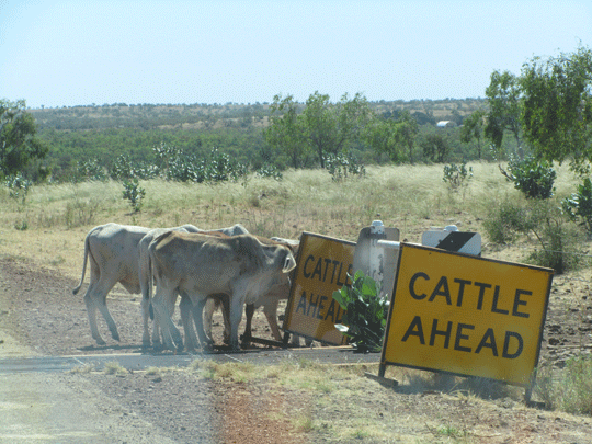
constructed as a beef road to transport cattle from the surrounding
stations to the ports of Derby and Wyndham.It spans some six-hundred
and seventy kilometres from Derby to the junction of the Great
Northern Highway between Wyndham and Kununurra. On passing through
a gap in the Napier Range, the majesty of the King Leopold Ranges
comes into view. • Climate: 2 seasons in this
part of Western Australia: Dry/Winter (April to September):
Little rainfall with mild to warm conditions Average
temperatures are maximum 30°C - 32°C, minimum 5°C - 12°C Humidity
levels are low, averaging between 30% - 40% in July
Wet/Summer (October to March): Heaviest rain
falling from January onwards, average 200mm in January. Average
temperatures are maximum 45°C, minimum 18°C - 22°C Humidity levels
averaging between 60% - 75%
|
|
Western Australia and National Parks (WA) towns,
rivers, roads, crossings, stopovers and places of interest (WA)
Map of the
Kimberley Western Australia |
Kununuura Region
Home Valley Station | Home
Valley Station | NT/WA
Quarantine Border Check Point | Wyndham
| Lake Argyle
|
Gibb River Road Region
Durrack River - Gibb
River Road | King
Edward River | Gibb River River
| Ellenbrae Station | Gibb
River Road | Mt
Barnett Roadhouse | Mitchell
River National Park | Pentecost
River | Manning Gorge | Bell
Gorge | Dimond Gorge & Sir John Gorge
| Galvins Gorge| Lennard
Gorge | Mt Hart |
Mitchell Plateau Region
Kalumburu | Drysdale
River Station | Mitchell
River National Park | Mertens
Falls | Mitchell
Plateau | Mitchell
River |
Four Wheel Hire - Darwin to Broome or Perth return
or continue on
Four Wheel Hire
- Darwin to Broome
or Perth return or continue on
Campervan Hire or Motorhome Rentals - Darwin to
Broome or Perth return or continue on
Campervan Hire
or Motorhome Rentals
- Darwin to Broome
or Perth return or continue on
|
|
|
|
|
|
About Karijini National Park Australia
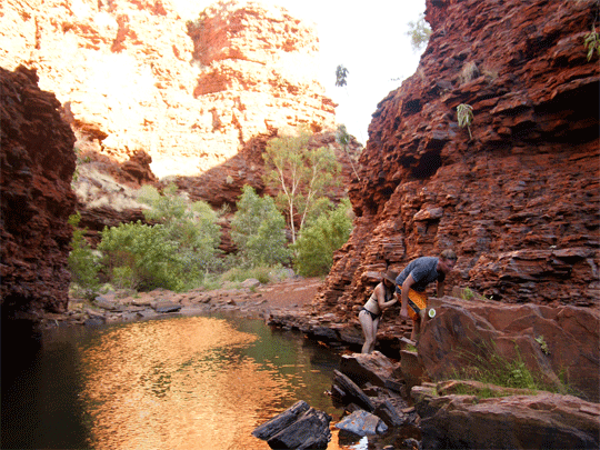
• Karijini (formerly Hamersley Range National Park) is the second
largest national park in WA. Situated just north of the Tropic
of Capricorn, the park's climate can best be described as tropical
semi-desert. The ideal times to visit the park are late autumn,
winter and early spring. Winter days are warm and clear, but nights
are cold and sometimes frosty.
Karijini National Park protects many different wildlife
habitats, landscapes, plants and animals of the Pilbara. Wildflowers
vary with the seasons. In the cooler months the land is covered
with yellow-flowering cassias and wattles, northern bluebells
and purple mulla-mullas. After rain many plants bloom profusely.
It is also home to a variety of birds, red kangaroos and euros,
rock-wallabies, echidnas and several bat species. Geckos, goannas,
dragons, legless lizards, pythons and other snakes are abundant.
Huge termite mounds are a feature of the landscape and the rock
piles of the rare pebble mound mouse may be found in spinifex
country.
|
|
Western Australia and National Parks (WA) towns,
rivers, roads, crossings, stopovers and places of interest (WA)
Map of the
Kimberley Western Australia |
Pilbara Region
Newman | Onslow
| Tom Price | Karijini
National Park | Marble Bar |
Four Wheel Hire - Darwin to Broome or Perth return
or continue on
Four Wheel Hire
- Darwin to Broome
or Perth return or continue on
Campervan Hire or Motorhome Rentals - Darwin to
Broome or Perth return or continue on
Campervan Hire
or Motorhome Rentals
- Darwin to Broome
or Perth return or continue on
|
|
|
|
|
|
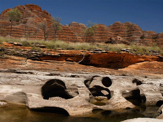
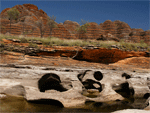
About Bungle Bungle Ranges
• Self drive to the Bungle
Bungle from Broome or Darwin in a 4wd camper rentals or 4wd
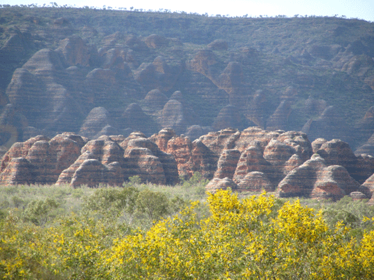
car hire. The Bungle Bungle Range rises up to 578 metres above
sea level. The range stands 200 to 300 metres above a woodland
and grass-covered plain, with steep cliffs on the western face.
Elsewhere, particularly where Piccaninny Creek has formed Piccaninny
Gorge, the range is cut by deep gullies and breaks up into complex
areas of ridges and domes, with prominent orange and black or
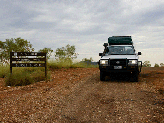
grey bands.Bungle Bungle turn-off to the park is 250 km south
of Kununurra or 109 km north of Halls Creek. The park access road
is accessible only to four-wheel-drive vehicles.• Population
: 28,000 people based in the regional centres of Broome,
Derby, Kununurra, and Hall's Creek. • Economy:
The main industries in the region are agriculture, pearling, mining
and tourism.
|
|
Western Australia and National Parks (WA) towns,
rivers, roads, crossings, stopovers and places of interest (WA)
Map of the
Kimberley Western Australia |
El Questro
Emma
Gorge Trail | El
Questro Gorge Trail | Amalia
Gorge Trail | Zebedee
Springs | Saddleback
Ridge | Moonshine
Gorge Circuit Walk | Champagne
Springs | El
Questro Wilderness Park | Pentecost
River |
Four Wheel Hire - Darwin to Broome or Perth return
or continue on
Four Wheel Hire
- Darwin to Broome
or Perth return or continue on
Campervan Hire or Motorhome Rentals - Darwin to
Broome or Perth return or continue on
Campervan Hire
or Motorhome Rentals
- Darwin to Broome
or Perth return or continue on
|
|
|
|
|
|
About Broome
• Broome Surrounds"
Area, "Kimberley" Region Broome has a
population of 10500 ( 1998 figures) and is approximately 2250
kilometres north of Perth, the capital city of Western Australia.
Broome simply oozes with colour. It's Western Australia's secret
getaway - right on the Indian Ocean's doorstep and the gateway
to Australia's last frontier of pristine wilderness - the Kimberley.
From its rough and tumble, romantic pearling history
to the cosmopolitan character of Chinatown, to the turquoise waters,
red sandstone cliffs and the endless expanse of white sand at
Cable Beach....the colours and moods of Broome will capture your
soul. You'll never want to leave.
Pilbara Region
Newman | Onslow
| Tom Price | Karijini
National Park | Marble Bar |
Australia's Coral Coast
Kalbarri | Exmouth
| Ningaloo Marine Park
| Ningaloo Reef | Denham
| Abrolhos Islands | Coral
Bay (Coral Coast) | Geraldton
| The Pinnacles |
South Coast
Leeuwin Naturaliste
National Park | Lake
Cave | Albany | Moore
River National Park | Greens Pool
| Rainbow Coast | Denmark
| Walpole | William
Bay National Park | Rainbow Coast
| Margaret River |
Four Wheel Hire - Darwin to Broome or Perth return
or continue on
Four Wheel Hire
- Darwin to Broome
or Perth return or continue on
Campervan Hire or Motorhome Rentals - Darwin to
Broome or Perth return or continue on
Campervan Hire
or Motorhome Rentals
- Darwin to Broome
or Perth return or continue on
|
|
|
|
|
|
About Exmouth - The Coral Reef and Ningaloo
• Self drive to the Exmouth
from Broome or Darwin
in your self drive 4wd camper or 4wd car rental from us. The coastline
region commencee at Cervantes, where you’ll find the unique rock
formations of the Pinnacles and stretches far north to Exmouth,
home of the internationally renowned World Heritage Listed Ningaloo
Reef, this amazing region is also excellent for fishing and diving
all year round with a variety of spectacular reefs and marine
life, white sandy beaches and warm turquoise waters.
The Ningaloo Marine Park stretches from Coral Bay
round the North West Cape to Exmouth. For snorkellers and nature
lovers, this is an irresistible opportunity.
Australia's Coral Coast
Kalbarri | Exmouth
| Ningaloo Marine Park
| Ningaloo Reef | Denham
| Abrolhos Islands | Coral
Bay (Coral Coast) | Geraldton
| The Pinnacles |
Four Wheel Hire - Darwin to Broome or Perth return
or continue on
Four Wheel Hire
- Darwin to Broome
or Perth return or continue on
Campervan Hire or Motorhome Rentals - Darwin to
Broome or Perth return or continue on
Campervan Hire
or Motorhome Rentals
- Darwin to Broome
or Perth return or continue on
|
|
|
|
|
|
About Perth and South West Coast
• Self drive to the Perth from Broome
or Darwin in your self
drive 4wd camper or 4wd car rental from us. Australia's South
West in Western Australia offers varied travel experiences. Discover
the towering forests then to whale watching, fine food and wine
to world class surfing. Australia's South West offers some of
the most varied travel experiences in Western Australia. Margaret
River and its surrounds are a popular destination for world-class
wineries, top surfing and fun family holidays. Albany's rugged
coastline creates a fitting backdrop to a dramatic whaling, convict
and settler history and a sensational south coast adventure.
|
|
South Coast
Leeuwin Naturaliste
National Park | Lake
Cave | Albany | Moore
River National Park | Greens Pool
| Rainbow Coast | Denmark
| Walpole | William
Bay National Park | Rainbow Coast
| Margaret River |
Four Wheel Hire - Darwin to Broome or Perth return
or continue on
Four Wheel Hire
- Darwin to Broome
or Perth return or continue on
Campervan Hire or Motorhome Rentals - Darwin to
Broome or Perth return or continue on
Campervan Hire
or Motorhome Rentals
- Darwin to Broome
or Perth return or continue on
|
|
|
|
|
|
About Darwin Australia
•Self drive from Darwin
the capital of Northern Territory to Broome on the Gibb River
Road a 4wd road or via the Great Northern Highway (seasonal conditions
apply).
Darwin
is located on the coast and is 253 from the Kakadu
National Park entrance gates on the nothern entrance being
the Arnhem
Highway. From Darwin you can self drive down 332klm ton the
Stuart Highway to Katherine and Katherine Gorge.
Things to do in Darwin: From the East Point Reserve,
to the Darwin Botanical Gardens. Walk along Nightcliff foreshore
or Casuarina Beach you are never without something to do. We even
have the open Deckchair Cinema a must for any visitor and nightlife
that's easy to get to such as the Mitchell Street entertainment
strip. Venture further out of Darwin and we come to the Outer
Greater Darwin region some 20-45klm out and see the Territory
Wildlife Park or the famous Jumping Crocodile Cruises on the Adelaide
River.
|
|
Darwin
Darwin (capital city
of NT ) | Darwin
| Katherine
| Batchelor | Palmerston
| Territory
Wildlife Park | Berry
Springs | Noonamah
| Acacia
Hills |
Four Wheel Hire - Darwin to Broome or Alice Springs
return or continue on
Four Wheel Hire
- Darwin to Broome
or Alice Springs return or continue on
Campervan Hire or Motorhome Rentals - Darwin to
Broome or Alice Springs return or continue on
Campervan Hire
or Motorhome Rentals
- Darwin to Broome
or Alice Springs return or continue on
|
|
|
|
|
|
About Katherine Gorge Australia
• Self drive to the Katherine
Gorge from Darwin in a 4wd camper or family RV motorhome hire.
Katherine Gorge is located in Nitmiluk National Park Australia
- • This 292,800 hectare Nitmiluk National Park is owned by the
Jawoyn Aboriginal people and jointly managed with the Parks and
Wildlife Service of the Northern Territory. The deep gorge carved
through ancient sandstone by the Katherine River is the central
attraction of the Park. • Nitmiluk National Park is located in
the Top End of Australia's Northern Territory.
Nitmiluk National Park has two main points of visitor
access. The Park's main entrance is located 30 km northeast of
Katherine via a sealed road. Katherine is located 310 km south
of Darwin along the Stuart Highway. • Leliyn Falls (Edith Falls)
on the western side of the Park, is reached by turning off the
Stuart Highway 42km north of Katherine then following a sealed
road for a further 19km.• The most comfortable months to visit
the Park are from May to September.
|
|
Katherine
Katherine
| Nitmiluk
National Park | Bitter
Springs | Elsey
National Park | Leliyn
Edith Falls | Cutta
Cutta Caves Nature Park | Springvale
Homestead Tourist Park | Mataranka
| Mataranka
Thermal Springs |
Katherine to Kununurra
Timber Creek
| Jasper Gorge
Gregory NP | Limestone
Gorge Gregory NP | Katherine
| Kununurra | NT/WA
Quarantine Border Check Point | Gregory
National Park | Keep
River National Park |
Four Wheel Hire - Darwin to Katherine or Kununurra
return or continue on
Four Wheel Hire
- Darwin to Katherine
or Kununurra return or continue on
Campervan Hire or Motorhome Rentals - Darwin to
Katherine or Kununurra return or continue on
Campervan Hire
or Motorhome Rentals
- Darwin to Katherine
or Kununurra return or continue on
|
|
|
|
|
|
About Litchfield National Park Australia
• Self drive to the Litchfield
Park from Darwin in a 4wd camper or family RV campervan hire.
Together with pristinewaterfalls and tropical swimming holes,
this is a truly beautiful destination found just south of Darwin,
Northern Territory. Litchfield
National Park features numerous waterfalls which cascade from
a sandstone plateau called the Tabletop Range, monsoon rainforests,
intriguing magnetic termite mounds and historical sites. Litchfield
Park is Darwin residents a favourite spot as 1-3 day destination
for it's waterfalls and magnetic termite mounds.
Why not 4WD tracks into some of the more remote
parts of Litchfield National Park and surrounding region or even
across the Darwin harbour to mandorah. Litchfield National Park
is approximately 130km's southwest of Darwin near the town of
Batchelor and covers around 1,500 sq km's.
|
|
Litchfield
Batchelor | Litchfield
| Litchfield
National Park |
Four Wheel Hire - Darwin to Litchfield
Four Wheel Hire
- Darwin to Litchfield
Campervan Hire or Motorhome Rentals - Darwin to
Litchfield
Campervan Hire
or Motorhome Rentals
- Darwin to Litchfield
|
|
|
|
|
About Kakadu National Park Australia
• Self drive to the Kakadu
National Park from Darwin in a 4wd camper or family RV motorhome
hire. Darwin is located on the coast and is 253 from the Kakadu
National Park entrance gates on the nothern entrance being
the Arnhem
Highway. From Darwin you can self drive down 332klm ton the
Stuart Highway to Katherine and Katherine Gorge.
|
|
Kakadu
Kakadu National
Park | Kakadu |
Koolpin Gorge | Arnhem
Highway from Darwin to Jabiru links to information on the following
destinations | Jabiru | Maguk
Barramundi Gorge | Ubirr Rock
| Nourlangie Rock | Gubara
| Warradjan-Aboriginal-Cultural-Center
| Yellow Water Cruises |
Coonida | Bowali
Visitors Centre | Jim Jim
Falls and Jim Jim Gorge | Twin
Falls | Motorcar Creek and Motorcar
Falls | Boulder Creek |
Arnhem Highway
Arnhem Highway from Darwin to
Jabiru links to information on the following destinations
| Jabiru | Wetlands
Region | Adelaide River Crocodile
Cruise | Windows to the Wetlands
| Corroboree Park Tavern | Termite
Mounds on Arnhem Highway | Mary
River National Park | Hardies
Track | Bark Hut Inn & Caravan
Park | Old Jim Jim Rd turnoff
| 2 Mile Hole and 4 Mile Hole 4WD
Track | South Alligator River
| Mamukala Wetlands - Birding
|
Four Wheel Hire - Darwin to Kakadu
Four Wheel Hire
- Darwin to Kakadu
Campervan Hire or Motorhome Rentals - Darwin to
Kakadu
Campervan Hire
or Motorhome Rentals
- Darwin to Kakadu
|
|
|
|
|
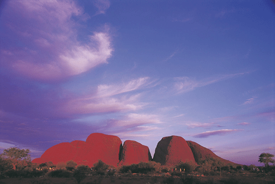
About Uluru Kata Tjuta National Park Australia
• Self drive to the Alice
Springs then onto Uluru
which was called Ayers
Rock, 45klm away to Kata
Tjuta once again known as The Olgas and 232klm (all approx)
to Kings Canyon. There is the famous Mereenie Loop a 4wd road
for our hire vehicles which comes into Glen Helen Gorge and the
West MacDonnell Ranges
and back to Alice Springs.
|
|
Stuart Highway
Stuart
Highway from Darwin to Alice Springs links to information on the
following destinations
Ti Tree Roadhouse
| Elliot
| Newcastle
Waters | Threeways
| Barrow
Creek | Daly
Waters | Adelaide
River | Noonamah
| Acacia
Hills | Hayes
Creek | Emerald
Springs Roadhouse | Pine
Creek | Larrimah
| Dunmurra
| Renner
Springs | Stuart
Memorial | John
Flynn Memorial | Tennant
Creek | Wauchope
Hotel and Roadhouse | Wycliffe
Well Holiday Park | Banka
Banka Station | Tropic
Of Capricorn Marker | Palmerston
| Territory
Wildlife Park | Berry
Springs | Noonamah
| Acacia
Hills |
Alice Springs
Alice Springs
|
Tanami Road
Tanami Road links to
information on the following destinations
Rabbit Flat | Wolfe
Creek Metorite Crater | Balgo
| Billiluna | Yuendumu
| Tilmouth |
Four Wheel Hire - Darwin to Alice Springs or from
Alice Springs
Four Wheel Hire
- Darwin to Alice
Springs or from Alice Springs
Campervan Hire or Motorhome Rentals - Darwin to
Alice Springs or from Alice Springs
Campervan Hire
or Motorhome Rentals
- Darwin to Alice
Springs or from Alice Springs
|
|
|
|
|
 |
Approx. Distances from Perth
01. Darwin -4040
03. Wyndham -3229
12. Karijini NP - 1400
13. Ningaloo + Coral Bay - Perth-1200Km
14. Monkey Mia - 856
...... Monkey Mia/Shell Beach 100Km Long
...... Monkey Mia/Shark Bay
15. Kalbarri -533
Approx. Distances from Broome (unless stated)
1. Darwin -1867Km
2. Katherine -314Km
3. Kununurra -1042Km
3. Kununurra - Darwin -850Km
3. Kununurra - Lake Arglye -79Km
3. Kununurra - NT Border -57Km
3. Kununurra to El Questro -162Km
0. (Gibb River Road 710Km Long)
3. Wyndham -1057Km
4. Mitchell Plateau - Broome - 880km
5. Bungle Bungles - Kununurra -299km
.... (In Purnululu National Park)
.... (Highway to park 53km)
Approx. Distances from Perth
16. Kalgoorlie -596
17. Perth -0
18. Margaret River -277
19. Albany -409
20. Esperance -721
21. Adelaide - Perth 2712
..... Melbourne - Perth -3438
Approx. Distances from Broome (unless stated)
6. Halls Creek -683Km
6. Halls Creek - Kununurra-370Km
7. Fitzroy Crossing -395Km
....7/8 is Tunnel Creek - 380Km
8. Derby -221Km
9. Broome -0
....Cape Leveque - 217Km nth of Broome
10. Port Hedland -597Km
11. Alice Springs to WA Border -740km
...... (Via Tanami Hwy)
12. Exmouth - 1394Km
12. Karijini NP – Broome or nearest main destination -1024km
...... Broome <>Tom Price
13. Ningaloo + Coral Bay - 1110Km Sth Broome
17. Perth - Broome - 2227
Please
note locations and distances on the map above are approximate
locations and measurment of distances. Any maps featured in
this website are not to scale and should be used as a guide
only.
|
|
|
|
|
|
|
|
Western Australia and National Parks (WA) towns,
rivers, roads, crossings, stopovers and places of interest (WA)
Map of the
Kimberley Western Australia |
Kununuura Region
Home Valley Station | Home
Valley Station | NT/WA
Quarantine Border Check Point | Wyndham
| Lake Argyle
| Kununurra
Gibb River Road Region
Durrack River - Gibb
River Road | King
Edward River | Gibb River River
| Ellenbrae Station | Gibb
River Road | Mt
Barnett Roadhouse | Mitchell
River National Park | Pentecost
River | Manning Gorge | Bell
Gorge | Dimond Gorge & Sir John Gorge
| Galvins Gorge| Lennard
Gorge | Mt Hart |
Mitchell Plateau Region
Kalumburu | Drysdale
River Station | Mitchell
River National Park | Mertens
Falls | Mitchell
Plateau | Mitchell
River |
Fairfields Leopold Downs Road Region
Fairfields
Leopold Downs Road | Geikie
Gorge | King
Leopold Ranges | Windjana
Gorge | Tunnel
Creek | Tunnel
Creek National Park |
Great northern Highway Kununurra to Derby to Broome
Fitzroy Crossing | Halls
Creek | Old Halls
Creek | China
Wall | Lilly Yard
| Sturt Creek |
Turkey Creek Roadhouse
| Mabel Downs
Station | Purnulula
National Park (Bungle
Bungle) |
Bungle Bungle Region
Purnulula
National Park (Bungle
Bungle) | Echidna
Chasm | Mini
Palms | Cathedral
Gorge | | Manning Gorge |
Turkey Creek Roadhouse
| Mabel Downs
Station | Bungle
Bungle | Bradshaw
Paintings |
El Questro
Emma
Gorge Trail | El
Questro Gorge Trail | Amalia
Gorge Trail | Zebedee
Springs | Saddleback
Ridge | Moonshine
Gorge Circuit Walk | Champagne
Springs | El
Questro Wilderness Park | Pentecost
River
Pilbara Region
Newman | Onslow
| Tom Price | Karijini
National Park | Marble Bar |
Australia's Coral Coast
Kalbarri | Exmouth
| Ningaloo Marine Park
| Ningaloo Reef | Denham
| Abrolhos Islands | Coral
Bay (Coral Coast) | Geraldton
| The Pinnacles |
South Coast
Leeuwin Naturaliste
National Park | Lake
Cave | Albany | Moore
River National Park | Greens Pool
| Rainbow Coast | Denmark
| Walpole | William
Bay National Park | Rainbow Coast
| Margaret River |
Northern Territory and National Parks (NT) rivers,
roads, crossings, stopovers and places of interest (NT)
Darwin
Darwin (capital city
of NT ) | Darwin
| Katherine
| Batchelor | Palmerston
| Territory
Wildlife Park | Berry
Springs | Noonamah
| Acacia
Hills |
Katherine
Katherine
| Nitmiluk
National Park | Bitter
Springs | Elsey
National Park | Leliyn
Edith Falls | Cutta
Cutta Caves Nature Park | Springvale
Homestead Tourist Park | Mataranka
| Mataranka
Thermal Springs |
Katherine to Kununurra
Timber Creek
| Jasper Gorge
Gregory NP | Limestone
Gorge Gregory NP | Katherine
| Kununurra | NT/WA
Quarantine Border Check Point | Gregory
National Park | Keep
River National Park |
Litchfield
Batchelor | Litchfield
| Litchfield
National Park |
Kakadu
Kakadu National
Park | Kakadu |
Koolpin Gorge | Arnhem
Highway from Darwin to Jabiru links to information on the following
destinations | Jabiru | Maguk
Barramundi Gorge | Ubirr Rock
| Nourlangie Rock | Gubara
| Warradjan-Aboriginal-Cultural-Center
| Yellow Water Cruises |
Coonida | Bowali
Visitors Centre | Jim Jim
Falls and Jim Jim Gorge | Twin
Falls | Motorcar Creek and Motorcar
Falls | Boulder Creek |
Arnhem Highway
Arnhem Highway from Darwin to
Jabiru links to information on the following destinations
| Jabiru | Wetlands
Region | Adelaide River Crocodile
Cruise | Windows to the Wetlands
| Corroboree Park Tavern | Termite
Mounds on Arnhem Highway | Mary
River National Park | Hardies
Track | Bark Hut Inn & Caravan
Park | Old Jim Jim Rd turnoff
| 2 Mile Hole and 4 Mile Hole 4WD
Track | South Alligator River
| Mamukala Wetlands - Birding
|
Stuart Highway
Stuart
Highway from Darwin to Alice Springs links to information on the
following destinations
Ti Tree Roadhouse
| Elliot
| Newcastle
Waters | Threeways
| Barrow
Creek | Daly
Waters | Adelaide
River | Noonamah
| Acacia
Hills | Hayes
Creek | Emerald
Springs Roadhouse | Pine
Creek | Larrimah
| Dunmurra
| Renner
Springs | Stuart
Memorial | John
Flynn Memorial | Tennant
Creek | Wauchope
Hotel and Roadhouse | Wycliffe
Well Holiday Park | Banka
Banka Station | Tropic
Of Capricorn Marker | Palmerston
| Territory
Wildlife Park | Berry
Springs | Noonamah
| Acacia
Hills |
Alice Springs
Alice Springs
|
Tanami Road
Tanami Road links to
information on the following destinations
Rabbit Flat | Wolfe
Creek Metorite Crater | Balgo
| Billiluna | Yuendumu
| Tilmouth |
|
