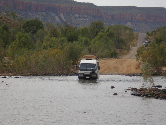
Pentecost River crossing Gibb River Road in the Kimberley Australia
Pentecost River is a river in the Kimberley region of Western
Australia. The river rises below the Durack Range and flows
north through El Questro Station where it meets with the Chamberlain
River, then continues north crossing the Gibb River Road, skirts
the eastern edge of Drysdale River National Park and later discharges
into West Arm and eventually into Cambridge Gulf. The river
has seven tributaries including; Chamberlain River, Salmond
River, Gap Creek, Five Mile Creek and Durack River.
©
source and courtesy of wikipedia.org
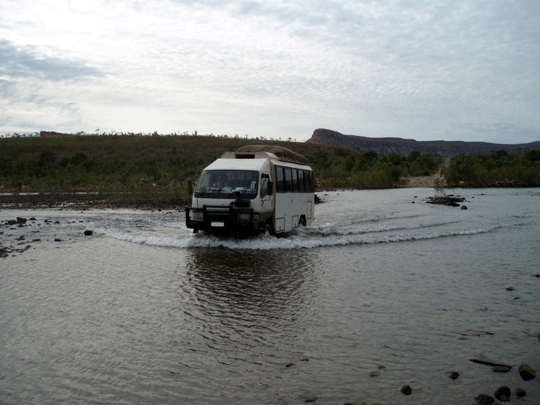
The Pentecost River is a major river crossing.
The river can be 60+ metres wide and the water often flows quickly
just after the end of the Wet Season . i.e. April -May.
Care should be taken at high water levels due to the flow of
the water exerting extreme pressure on the side of the vehicle.
By the end of the dry season, September to October on average,
the flow of the Penecost River is greatly reduced with the depth
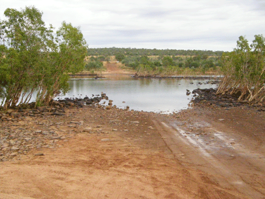
less than 50 cm and it is much safer to cross / ford. A scenic
area with panoramic views towards the Cockburn Ranges and nearby
sight of some campsites along the east and west banks of the
Penecost River on the northern side of the crossing. The Pentecost
rises in the Durack Range and flows north through El Questro
Station where it joins the Chamberlain River, then continues
north crossing the Gibb River Road, skirts the eastern edge
of Drysdale River National Park and later discharges into the
west arm of the Cambridge Gulf.
The Pentecost River crosses the Gibb River Road in the Kimberley
region of Western Australia. This crossing is a significant
landmark on the Gibb River Road, known for its beauty and potential
for fishing. The river rises in the Durack Range and flows northward,
meeting the Chamberlain River before crossing the Gibb River
Road.
The crossing is a popular spot for camping and fishing, but
travelers should be aware of the potential presence of saltwater
crocodiles.
Pentacost River crossing twa 2006 - seasonal suggest after June
better crossing access
The Pentecost River distance to the Durack River crossing
on the Gibb River Road
Approx. 1 hr 30 min (95.0 km) via Gibb River-Wyndham Rd
Pentecost
River to Durack River directions on Google Maps
Other places
Durrack River - The Durrack River crossing can be high at the beginning of the Dry season.
It's prone to flooding in wet season so make sure
you check road conditions. Also check the road is passable and
open. From Derby to the Durrack River it's approximatley 510
klm. (Distance is approx only). See the offical vistors information
centre in either of the Kununurra Visitor Centre, Derby Visitor
Centre, Broome Visitor Centre first.
Durrack River Crossing - seasonal suggest after June better
crossing access
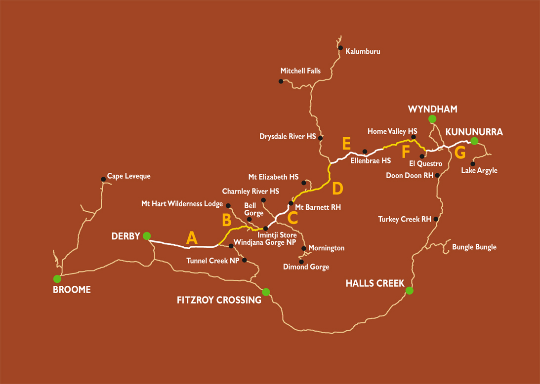
Gibb River Road
Self drive along the Gibb
River Road from Broome or Darwin is a Australia four wheel
drive hire camper or wagon. The Gibb River Road was initially
constructed as a beef road to transport cattle from the surrounding
stations to the ports of Derby and Wyndham.It spans some six-hundred
and seventy kilometres from Derby to the junction of the Great
Northern Highway between Wyndham and Kununurra.
The Gibb River road travels some 700 kms through the central Kimberley Plateau from King Sound at Derby to the Cambridge Gulf at Wyndham. The whole road is now the responsibility of Main Roads WA and improvements to creek crossings and jump ups are being made every year. The majority of the road surface is of dirt and gravel construction with only some floodways paved. The Derby Visitor Centre recommends use of high clearance robust vehicles, preferably 4WD, for DRY season (May to October) travel. Towing of any type is not recommended. However, well constructed off road trailers may survive the often corrugated conditions in the DRY. Caravans are definitely NOT recommended.
Wet season (November to April) travel can be severely restricted by flooding and road closures as the countryside can become very waterlogged. Access to the gorges is very often not possible and, if travel occurs, is restricted to the Gibb River Road itself and not to the sidetracks into the gorges. A 4WD vehicle equipped with a snorkel is essential once the rains have started. Travellers in breach of official Road Closure and Road Restrictions are subject to fines.
Land Ownership
All of the land along the Gibb River Road is owned, leased and
managed by someone. Much is subject to pastoral lease and some
belongs to Aboriginal Communities. The Department of Conservation
and Land Management manage the national parks, conservation
parks and nature reserves. If travellers wish to travel on any
roads bar the Gibb River Road, Mornington Road, the Kalumburu
Road, or gorge access roads as listed in the Gibb River Road
Guide, then they should seek permission of the landholder. All
roads other than those listed above are constructed and maintained
by the landowner and are not public roads.
Travelling with Dogs:
There are very limited places along the Gibb River Road that
will allow dogs. No dogs are allowed in any of the National
Parks along the Gibb River & Kalumburu roads. It is not advisable
to be travelling with your dog, land on both sides of the Gibb
River Road is owned, leased or managed by someone. Frequent
aerial baiting is carried out posing a high risk of danger to
your domestic pet.
©
source and courtesy of www.derbytourism.com.au
When can I travel on the Gibb River Road
Gibb River Road conditions improve greatly after the Derby and
Kununurra local roads graders complete the grading from Derby
and Kununurra.
Normally from this time onwards the Gibb River road is great to travel on, usually with hardly any corrugation or washouts. Though at the very beginning of the season after the graders please travel carefully as out clients got 2 punctures the day after the grader went through as the shale was chipped from the grader.
Also late in the season the roads becomes corrugated again with dust banks on the verge so again please be careful. The other suggestion is make sure you passenger talks to keep you awake and alert as the long open stretches can mesmerize the driver especially with the sun flickering through the branches of threes on certain stretches
What rivers, springs, creeks cross the Gibb
River Road
• Pentecost River - The Pentecost River crossing is in a
pleasant setting though very much like the Durack River this
is one of the rivers that can be rather tense to 4wd first timers
to cross early in the Dry Season. From Derby to the Penecost
River it's approximatley 605 klm. (Distance is approx only).
Beware of crocodiles and see the offical vistors information
centre in either of the Kununurra Visitor Centre, Derby Visitor
Centre, Broome Visitor Centre first.
• Lennard River
• Bindoola Creek
• Billy Goat Springs
• Durrack River - The Durrack River crossing can be high at
the beginning of the Dry season. It's prone to flooding in wet
season so make sure you check road conditions. Also check the
road is passable and open. From Derby to the Durrack River it's
approximatley 510 klm. (Distance is approx only). See the offical
vistors information centre in either of the Kununurra Visitor
Centre, Derby Visitor Centre, Broome Visitor Centre first.
What Gorges are on the Gibb River Road
• Following the Gibb River Road you can visit:
• Barnett River Gorge
• Manning Gorge
• Galvans Gorge
• Adcock Gorge
• Bell Gorge
• Silent Grove and
• Lennard River Gorge
What roadhouses are on the Gibb River Road
• Mount
Barnett Roadhouse
• Imintji Roadhouse
What Cattle Station with accommodation or camping
on the Gibb River Road
Ellenbra Station see section E of the map below. +(618) 9161
4325
Ellenbrae Station is primarily a cattle station, however, in
recent years we have been adding to our facilities to make sure
we can also be a welcome destination for those travelling along
the Gibb River Road. Ellenbrae Station covers 1 million acres
in the Kimberly, Western Australia. It is approximately 230km
from Kununnarra on the Gib River Road. Predominantly a cattle
station, it has become a popular stop over for tourists during
the dry season. Ellenbrae also invites day visitors to come
and enjoy a hot cup of tea in the beautiful gardens and the
best home made scones on the Gibb River Road! Ellenbrae’s driveway
is only 5km long so it is well worth the trip in to stop off
and stretch your legs, play with our homestead cattle or just
to marvel at the gardens and surrounds.
The Ellenbrae Station offers the following services
for day guests:
• Toilets • Picnic Area •Tyre Repairs • Cold Drinks/Food
The Ellenbrae Station offers the following services
for our overnight guests:
• Cabin Accommodation (Ellenbrae Stockmen’s Cabins) • Two Campsites
• Toilets • Showers (with Hot water!) • Dinner and Breakfast
(for Cabin Guests) • BBQ facilities (for Cabin Guests) • Outdoor
Camping Kitchen (for Cabin Guests) • Fishing • Swimming • Bush
Walks
• How far is it from Ellenbrae Station to Mt Barnett
Roadhouse 180kms (approximately 3.0 hours driving)
• How far is it from Ellenbrae Station to Kununurra 230 kms
(approximately 3.5 hours driving)
• How far is it from Ellenbrae Station to Derby 485 kms (approximately
7 hour driving)
• How far is it from Ellenbrae Station to Home Valley Station
110 kms (approximately 2.0 hours driving)
• How far is it from Ellenbrae Station to El Questro Wilderness
Park, Station Town Ship 155 kms (approximately 3.0 hours driving)
©
source and courtesy of www.ellenbraestation.com.au
Home Valley Station
Home Valley Station see section f of the map below. +(618) 9161
4322
Home Valley Station is located close to the mighty Pentecost River, at the foot of the majestic Cockburn Range. Experience the exhilaration of an authentic cattle muster, soak in the unforgettable scenery of the East Kimberley and be inspired by the region's Indigenous people.
At Home Valley Station we pride ourselves on providing guests with the ultimate Australian outback experience. Accommodation across the Station provides options for travellers - from those who prefer their rugged outback adventure those seeking a more intimate experience. Our spacious Grass Castles on idyllic Bindoola Creek are generously appointed, providing guests with the ultimate in outback lodging. Guesthouse Rooms provide a comfortable retreat and are perfect for couples and families. The safari-style Eco Tents, located in a quiet bush setting, will impress those seeking to connect with nature. Those wishing to roll out a swag under the stars are invited to enjoy the Gibb River Road's best camping facilities at our Station Campground and the picture perfect Pentecost River Bush Camp.
Home Valley Station (2025)
No, Home Valley
Station does not sell fuel.
For facilities offered such as fuel ring first +(618) 9161 4322
(including about if they have fuel)
If you are headed east, El
Questro is the closest place to refuel, which is 49km away.
If you are headed west, Mt.
Barnett Roadhouse is the closest, which is 280km away.
©
source and courtesy of https://home-valley.com.au/
Distances between individual Gibb River Road
fuel supply places if travelling to Kimberley Gorges
• How far is it from Mount Barnett Roadhouse to Imintji Roadhouse
- it's approximatley 86 klm (Fuel: Diesel & Unleaded) ©
source and courtesy of outbacktravellers.com.au
• How far is it from Mount Barnett Roadhouse to Imintji Roadhouse
- it's approximatley 78 klm (Fuel: Diesel & Unleaded) Other
sources
• How far is it from Mt Barnett Roadhouse to Kununurra - it's
approximatley 407 klm
• How far is it from Imintji Roadhouse to Fitzroy Crossing (Geikie
Gorge) - it's approximatley 296 klm
• How far is it from Broome to Derby - it's approximatley 222
klm (Fuel: Diesel & Unleaded)
• How far is it from Imintji Roadhouse to Derby - it's approximatley
227-232 klm (Fuel: Diesel)
• How far is it from Fitzroy Crossing to Mt. Barnett Roadhouse
via Bell Gorge - it's approximatley 365 klm
Milage is approximates only check at these offical visitor centres before leaving on your Kimberley self drive: Kununurra Visitor Centre, Derby Visitor Centre, Broome Visitor Centre.
Where the Gibb River flows in Western Australia
The headwaters of the river rise between the Caroline and Gibb
Ranges. The river flows in a northerly direction until merging
with the Drysdale River, of which it is a tributary. Gibb River
has three tributaries: North Creek, Plain Creek and Russ Creek.The
Gibb River drops approximatley 125+m over its approximate 100km
length. The 3 following creeks and rivers flow into the Gibb
River being the Russ Creek, North Creek and Plain Creek.
©
source and courtesy of www.hallscreektourism.com.au/
©
source | courtesy of outbacktravellers.com.au
©
source | courtesy of Derby Visitors Centre
-
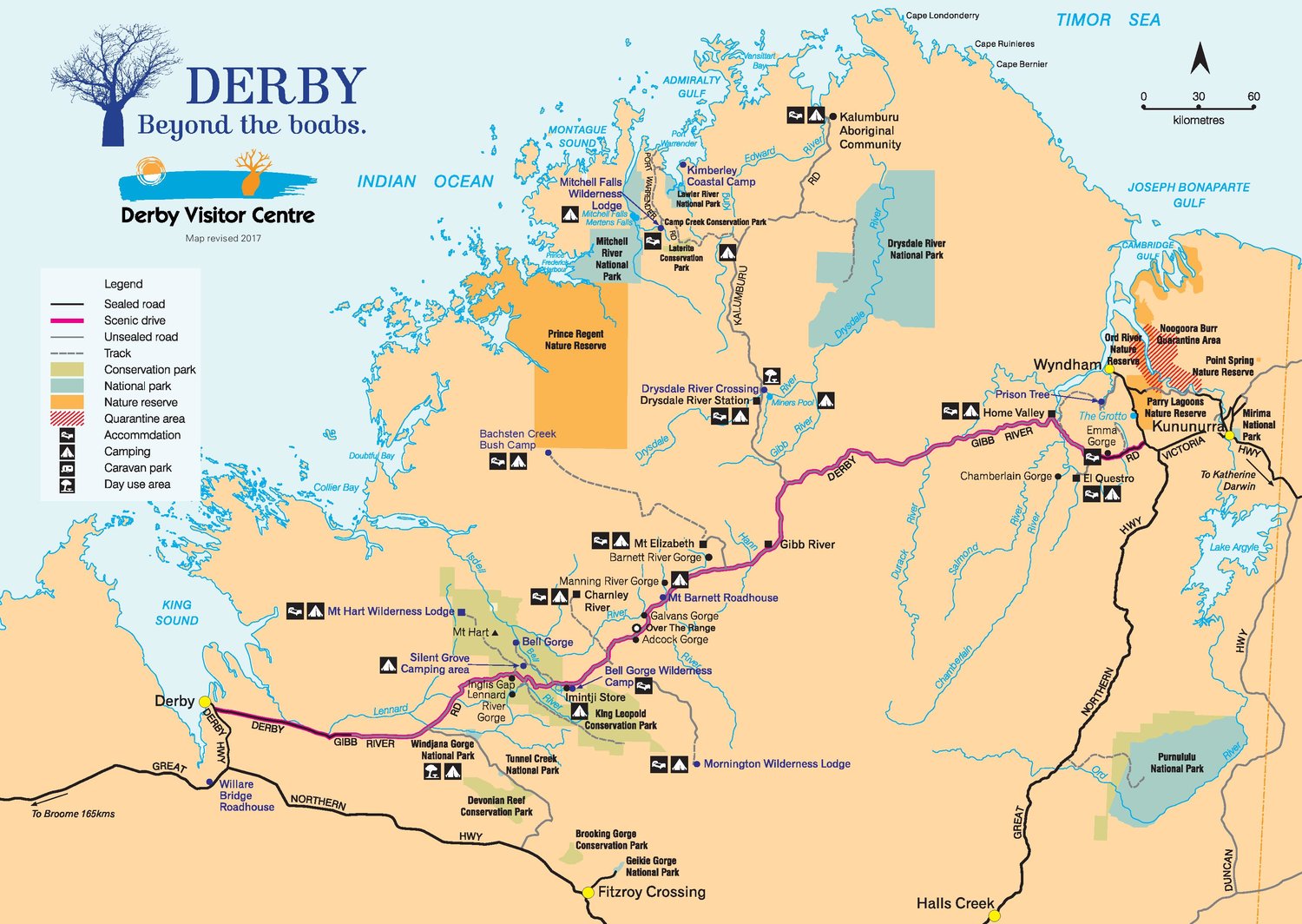
4wd Wagon hire -
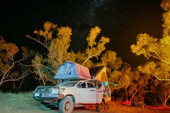 4wd camper family of 5
4wd camper hire for a family of May till October Broome and Darwin
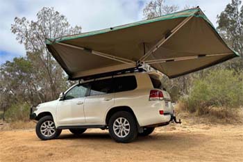
Darwin 4wd camper
-
 4wd Adventure Camper
Sleep inside more room better kitted out Adventure camper rental
4wd camper Darwin