|
About Nourlangie Rock in Kakadu Australia |
Where Is Nourlangie Rock
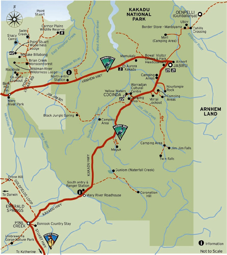
Turn off the kakadu Highway 19km south of the Bowali Visitor
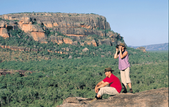
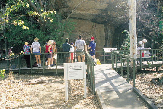
Centre and travel a further 12 km. Nourlangie Rock: a 1.5km circular
walk will take you past an ancient Aboriginal shelter and several
outstanding art sites. For the adventurous, there is also a moderately
steep climb to Gunwarddehwardde lookout, which provides impressive
views of Kakadu's escarpment and Nourlangie Rock. Open all year
round, entry is free. Continuing on from the Nourlangie car park,
the road provides access to several interesting walks and Aboriginal
art areas including Anbangbang Billabong, the Nanguluwur art site,
and Gubara Pools.
How Get To Nourlangie Rock
Kakadu National Park an Australian Natural
Icon covers almost 20,000 square kms and is 253 kms East of Darwin
the capital city of the Northern Territory, Australia.
Kakadu National Park is a World Heritage
listed, Kakadu National Park is the gateway to Arnhemland. The
sealed roads from Darwin to Kakadu is via the Arnhem Highway and
from Katherine to Kakadu National Park via the Kakadu Highway.
The Bowali Visitor Centre near Jabiru in Kakadu National Park
is located 253 km from Darwin in Northern Territory Australia
via the Arnhem Highway entrance. If travelling by road, you should
allow 3 hours travelling time from Darwin.
Access To Nourlangie Rock
Over 5,000 recorded and identified Aboriginal art sites, Kakadu
contains an uniqueartistical living cultural landscape of Aboriginal
art. Ubirr and Nourlangie Rock are two of
the most pristine public sites that feature Aboriginal Cultural
Rock Art and previous dwelling shelters.
The dry season which is approximatley which
is classed generally as May - October each year. Though in current
year the wet has not set in till late December or January and
then finishes mid April.
Walking:
A 1.5km circular walk takes you past an ancient
Aboriginal shelter and several outstanding art sites. A moderately
steep climb to Gunwarddehwardde lookout provides impressive
views of Kakadu's escarpment and Nourlangie Rock.
If you have more time
Anbangbang (Arn-barng-barng) Billabong (Check
wet season access)
Where: After leaving the Nourlangie carpark, take the first
road to the left.
Features: Several picnic tables and a 2.5km dry season
circular walk. With Nourlangie Rock forming an impressive backdrop,
this is one of Kakadu's most attractive billabongs. Allow 1 hour.
Notes: Anbangbang Billabong walk (dry season only) Distance:
2.5 km Time: 1 hour return Grade: Easy Start: Nawurlandja parking
area or Anbangbang Billabong parking area Follow the yellow-tipped
posts around Anbangbang Billabong to see lilies, waterbirds and
stunning views of Burrunggui (Nourlangie Rock).
Nawurlandja (Now-oo-larn-ja) Lookout walk
Where: After leaving Nourlangie carpark, take the second road
to the left.
Features: A 600m climb up a moderately steep slope offers
good views of the escarpment and Anbangbang Billabong. Allow 40
minutes.
Nanguluwur (Narng-oo-loo-war) art site walk
Where: After leaving the Nourlangie carpark, take the first
road to the right.
Features: An easy 3.4km return walk through woodlands leads
to a quiet art site with some interesting Aboriginal rock art.
Allow 2 hours.
Gubara (Goo-bar-rar) Pools walk (check wet season
access)
Where: After leaving the Nourlangie carpark, take the first
road to the right and travel a further 9km.
Features: A 6km return walk past sandstone cliffs to shady
monsoon forest pools. A pleasant place to spend the heat of the
day. Allow 4 hours.
Bubba (Boop-bar) walk (dry season only)
Where: Starts at the entrance of the Muirella Park Camping
Area.
Features: A 3.5km circular walk through several wetland
habitats. Allow 2 hours.
Mirrai (Mirr-eye) Lookout walk
Where: Turn south-east off the kakadu Highway 30km south of
the Bowali Visitor Centre.
Features: A moderately difficult 3.6km return walk to a
platform lookout on top of Mount Cahill. It is a steep climb.
Allow 1.5 hours.
Sanstone platea Nawurlandja is a sandstone
outlier with species typical of stone country. This habitat is
home to endemic species, like the chestnut-quilled rock-pigeon
and the elusive short-eared rock wallaby. Resurrection grass (Micraira
sp) grows in hollows where soil collects. This plant appears dead
in the dry season, but comes to life at the start of the wet season,
forming a thick green mat. The sandstone pandanus (Pandanus basedowii)
has distinctive prop roots and a growth habit quite different
to the two lowland pandanus species. Figs (Ficus spp.) send their
roots spreading all over the rocks as they seek moisture and provide
support. During the wet season, the stone country provided Bininj
with shelter and painting sites. Bininj also hunt and gather stone
country foods when the lowlands are flooded. Bush currants (Buchanania
arborescens), rock and sandpaper figs (Ficus spp.) are collected
and eaten along with nectar from Dryanders grevillea (Grevillea
dryandri).
Talks At Nourlangie Rock
During the dry season, rangers provide informative talks about
Aboriginal art and culture several times a day.
Talks: During the dry season, rangers provide informative talks
about Aboriginal art and culture several times a day
Where to stay
Muirella Park Camping Area (check wet season access)
Access to showers, toilets and a generator is available. Camping
fees (adults only) are collected on site during the dry season.
Please pay at the Bowali Visitor Centre during the wet season.
Bush Camping Area (Dry season only, 4WD recommended)
A free camping area with composting toilet is available beyond
Muirella Park at Sandy Billabong. Drinking water is not available
http://www.environment.gov.au/
Parks & Wildlife Commission of the Northern
Territory
Head Office - Goyder Centre 25 Chung Wah Tce Palmerston, NT 0830
PO Box 496 Palmerston NT 0831
Ph: +61 (0) 8 8999 5511
Crocodile Safety Information
Northern Australia is crocodile country. Therefore it is important
to put awareness of crocodiles and safety at the top of your priority
list when living in, working in or simply visiting crocodile habitat.
Living with crocodiles is not difficult so long as you bear the
following points in mind.
Always be aware that crocodiles
may be present anywhere that there is water.
Unless there is clear signage that
it is safe to swim, assume that crocodiles may be present.
Warning signs are there for your
benefit! Ignoring them is foolish.
Always check with local authorities
and rangers whether an area is likely to contain crocodiles.
If in doubt, always swim in designated
swimming areas only.
If there's no sign, don't go swimming.
A spotlight or LED head-torch is
strongly recommended at night so that any eyeshines can be seen,
but a lack of eyeshines does not mean that it's safe to swim -
crocodiles may be underwater.
© We suggest you also visit a website called
http://www.nt.gov.au/becrocwise
Kakadu General Information
There are many interesting places to discover in the area, but
some things to remember too:
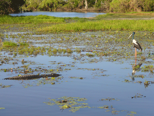
Saltwater crocodiles inhabit the South Alligator River and are
extremely dangerous. Do not risk your life, keep away from the
waters edge.
Freshwater crocodiles inhabit the area. Do not approach or interfere
with them.
Do not jump off rocks or cliffs as there are unseen dangers
and accidents have resulted in death.
Jim Jim Plunge Pool can be hazardous as the shallow water suddenly
becomes deep.
Use the toilets provided.
Observe and enjoy the native animals, but do not disturb or
feed them. Fishing is prohibited.
Use fuel stoves in preference to open fires.
If lighting open fires, collect firewood along the access road
into Gunlom and use it sparingly. Use the fireplaces provided,
attend fires at all times and extinguish them before you leave.
Use the recycling facilities supplied and place all other rubbish
in the bins. Remember, cigarette butts, orange peel and tissues
are rubbish too.
Sunscreen and insect repellent pollute waterways. Wear a long-sleeved
shirt and hat as alternative protection.
The mornings and evenings are the best times to walk and observe
wildlife. For your own comfort and safety please keep to the marked
tracks, wear a hat and sturdy shoes, and carry plenty of drinking
water.
Kakadu National
Park - Seasons
But Australia's Kakadu sees seasons of varied extremes -- so
varied, in fact, that the park's longtime aboriginal inhabitants
have divided the year into six distinct seasons.
Kakadu Seasons - Gunumeleng Pre-Monsoon Storm Season - Gunumeleng,
from mid-October to late December, may in fact last from a few
weeks to several months.
Kakadu Seasons - Gudjewg - Monsoon Season - Gudjewg, from January
to March, can be described as the 'true' wet season.
Kakadu Seasons - Banggereng - Knock 'em down storm Season -
Banggerreng, in April, is the season when the rain clouds have
dispersed and clear skies prevail.
Kakadu Seasons - Yegge - Cooler but still humid Season - Yegge,
from May to mid-June, is relatively cool with low humidity.
Kakadu Seasons - Wurrgeng - Cold Weather Season - Wurrgeng,
from mid-June to mid-August, is the 'cold weather' time; humidity
is low, daytime temperatures are around 30°C and night-time temperatures
are around 17°C.
Kakadu Seasons - Gurrung - Hot Dry Weather - Gurrung, from mid-August
to mid-October, is hot and dry.
Seasons
The dry season which is approximatley which
is classed generally as May - October each year.Though in current
year the wet has not set in till late December or January and
then finishes mid April.
Access To Jim Jim Gorge
The dry season which is approximatley which is classed generally
as late June - October/November each year. We
recommend you contact the offical Bowali Vistors Centre for more
information.
Kakadu National Park - Swimming
Are there certain times of the year that I cant swim?
The seasonality of waterholes across the Northern Territory depend
on the amount of rain throughout the year. NT Parks and Wildlife
monitor water levels and erect signs advising visitors when it
is safe to swim. Always obey sign posts.
How can you identify if a water-hole is safe to swim in?
Salt and freshwater crocodiles are found in most Top End billabongs
and rivers, and are occasionally seen on remote beaches. The accessible
rivers and billabongs are generally sign-posted if saltwater crocodiles
are known to inhabit the area, but if you are not sure, dont
swim. Swim only where recommended and always observe and read
the crocodile warning signs.
Arent swimming spots hard to get to or only acesible as part
of a tour?
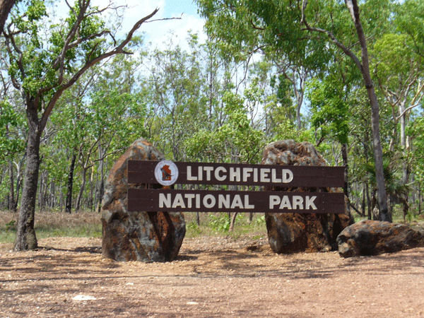
All the swimming spots in Darwin, Litchfield National Park, Katherine,
Mataranka and the MacDonnell Ranges are accessible by self-drive.
A few locations are only accessible by four wheel-drive, such
as Butterfly Gorge Nature Park and Tjaynera Falls in Litchfield
National Park. Tour operators with swimming options include Adventure
Tours Australia, Australian Pacific Touring, Connections Safaris,
Odyssey Tours and Safaris and many more'.
Resources
Links
parksandwildlife.nt.gov.au/
environment.gov.au/parks/
facebook.com/RoadReportNT
roadreport.nt.gov.au/
ntlis.nt.gov.au/roadreport/
toiletmap.gov.au/
travelnt.com/
kakadu.com.au/access
©
source | courtesy of kakadunationalparkaustralia.com
©
source | courtesy of litchfieldnationalpark.com
©
source | courtesy of tropicaldarwin.com
©
source | courtesy of australia4tours.com
©
source | courtesy of darwin4tours.com
|
